

US70 generally follows the old wagon road from Mesilla to Tularosa, but off the highway almost all the lower Tularosa Basin is strictly off-limits, either as part of Holloman AFB or White Sands Missile Range. And don’t consider trespassing — empty as it seems, this is some of the most thoroughly surveilled country on the planet. If you have a nagging feeling you’re being watched, you probably are; Holloman trains drone pilots who hone their skills by randomly tracking vehicles and pedestrians in the surrounding area.

White Sands National Monument offers excellent opportunities for sampling the local terrain, however. The Playa Trail is a short (1/4 mile) stroll on the edge of the dunes, while the Alkali Flat Trail provides a total immersion experience in traversing the dunes themselves. Pay attention to the tall poles marking the trail and don’t wander away from one without having the next in sight. Although they follow a pattern recognizable from the air, on the ground the crescent shape of the dunes can be very confusing, so that what seems to be a shortcut can quickly leave you turned around, disoriented and hopelessly astray. Don’t count on backtracking at need — even a light breeze across the sands can erase your footprints in minutes. Carry a compass and GPS, wear a hat, sunglasses and sunscreen, and never go out of sight of your vehicle without plenty of water.
The powdery sand makes travel tiring and slow for both man and horse, and there is no potable water. But the Sands were not terra incognita for Indians or cavalry. Chasing horse thieves in July 1871, Co. “A” of the 9th Cav spent 10 hot and thirsty days tracing out a maze of trails threading the dunes. The soldiers believed the remote and inhospitable region was a clandestine meeting place where Apache and Comanche raiders traded stolen livestock and other loot to the Comancheros in exchange for guns and ammunition.
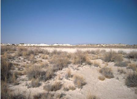
The flats bordering the dunes turn into a salty morass of gypsum mud in the rare rains, drying into a thin, frangible crust between times.
We can’t follow Nana and Guilfoyle into the San Andres today. The mountains are now a combination missile range and wildlife refuge – an oxymoron only the federal government could embrace – and are strictly off limits to the public. White Sands Monument permits backcountry camping, if you’re in shape to hike in and out. But for tent and RV campers, the closest overnight choices from the Sands are either a return to Oliver Lee SP or push on southwest to Aguirre Springs.

Aguirre Springs campground is tucked into a canyon where the eastern slope of the Organ Mountains abruptly rises into sheer cliffs. Fire rings, picnic tables, sun shelters and pit toilets are provided. Campsites are well spaced out over the piñon-studded hillside, offering expansive views over the Tularosa Basin. Two hiking trails offer the chance to experience the high Chihuahuan desert and give a taste of what it was like for Lt. Guilfoyle and his men to climb into the San Andres. Since it’s only 15 miles or so from Las Cruces, the campground is crowded with picnickers on holidays and weekends, but it’s generally pretty empty weeknights. Camping fee is $7 a night.

2 Replies to “White Sands & Aguirre Springs”